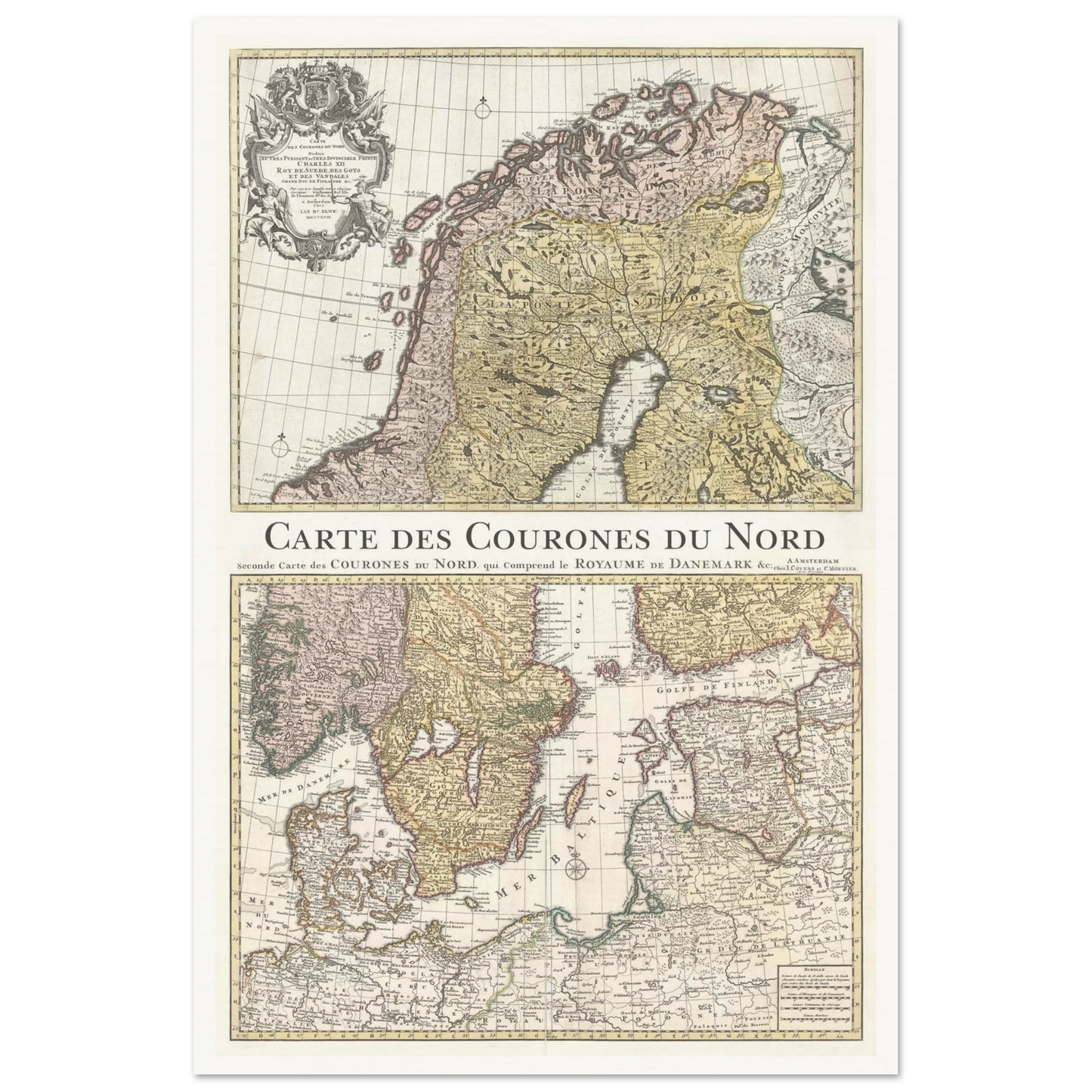
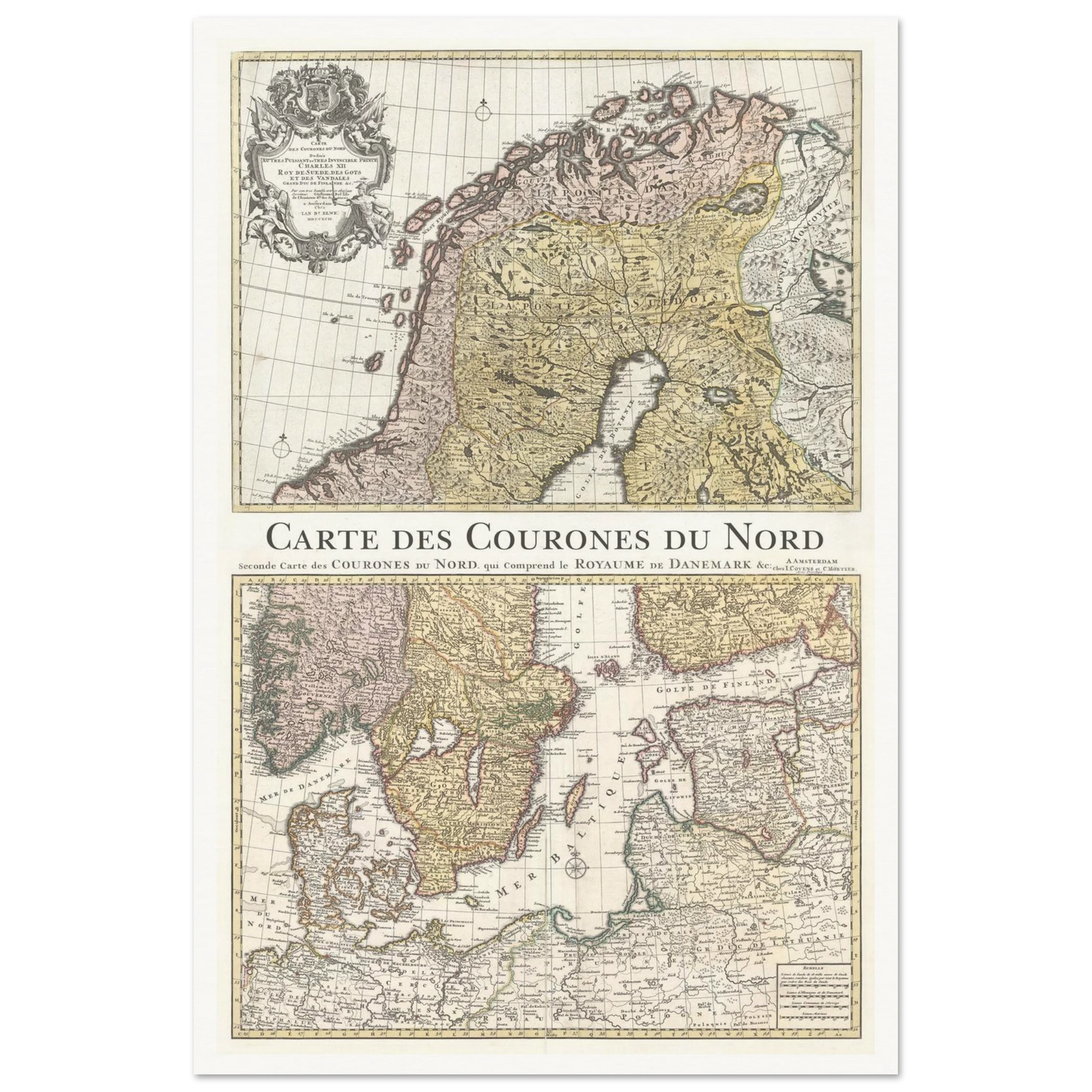
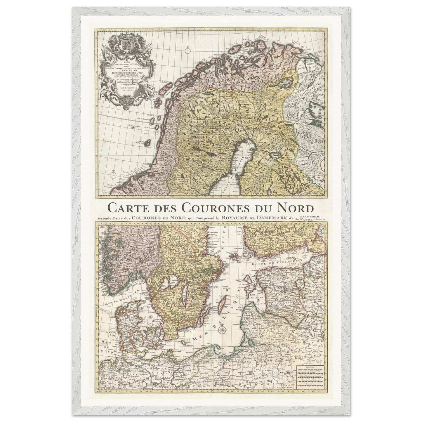
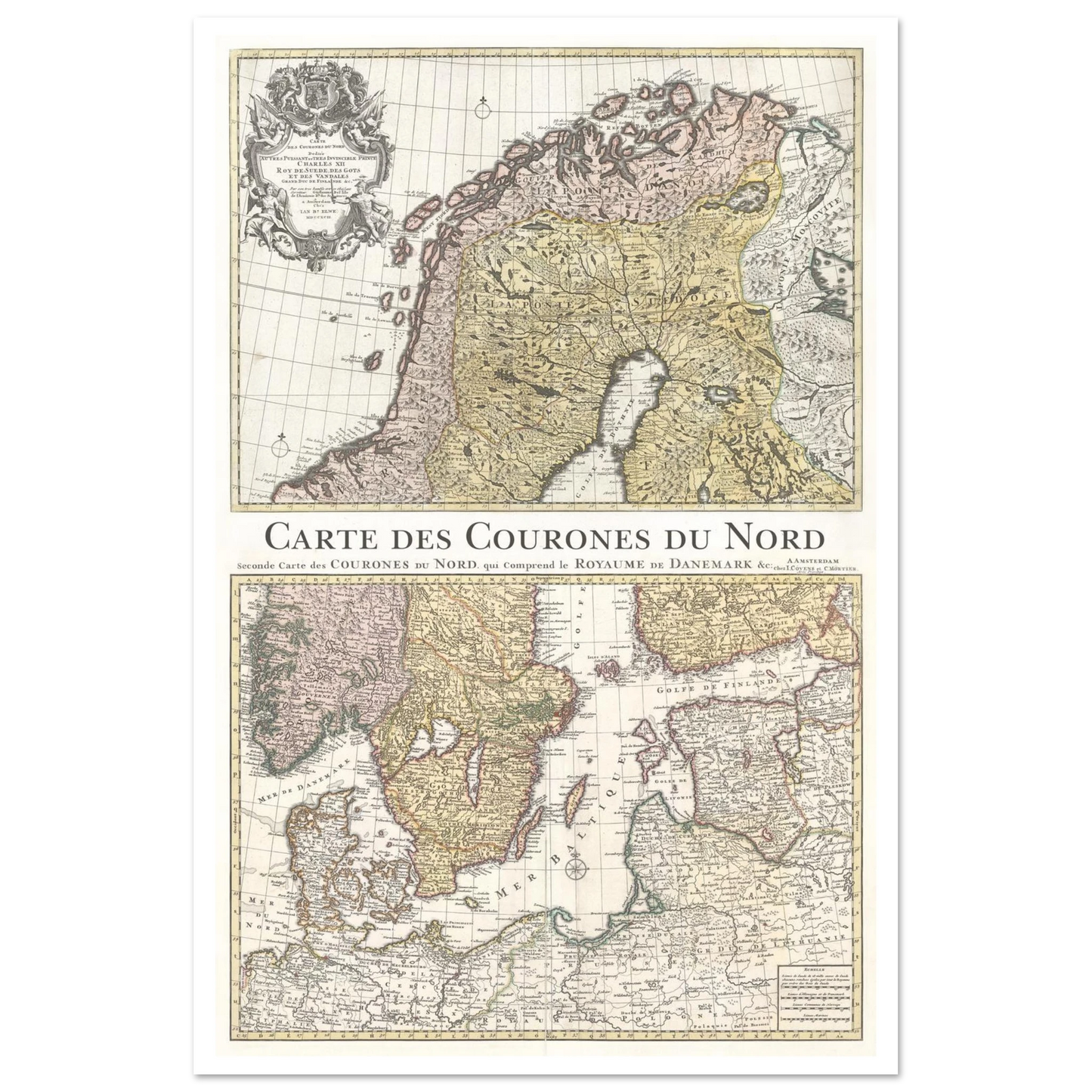
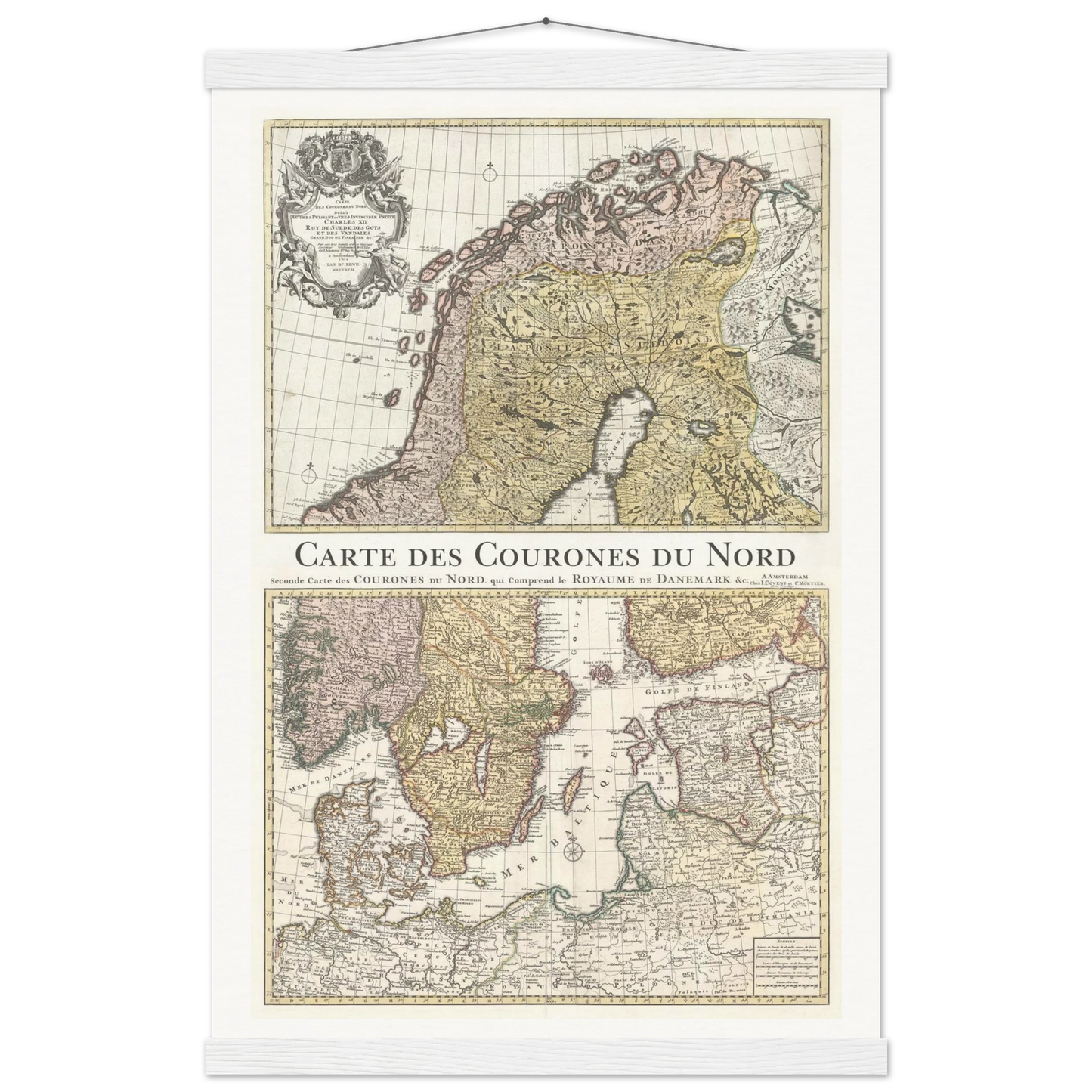
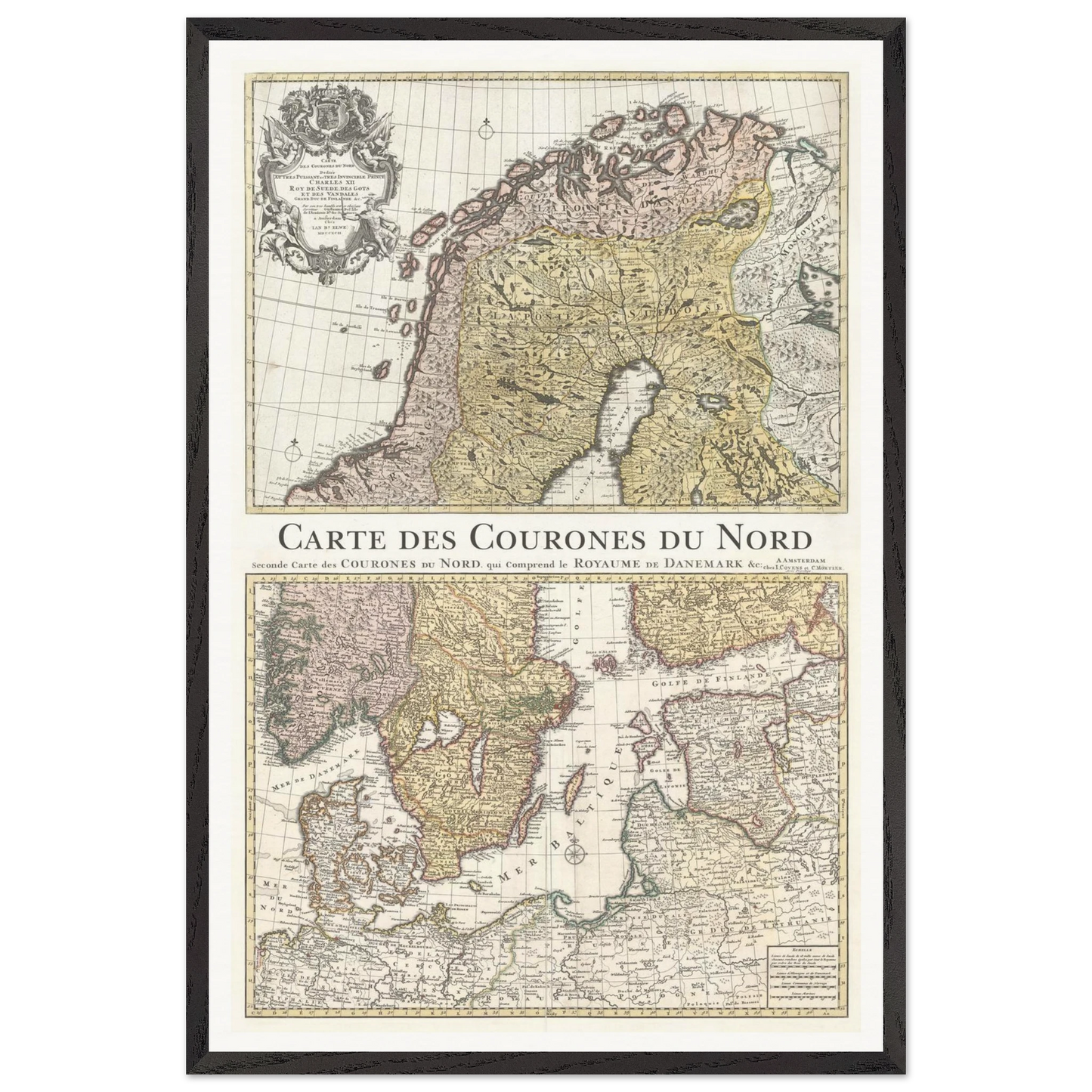
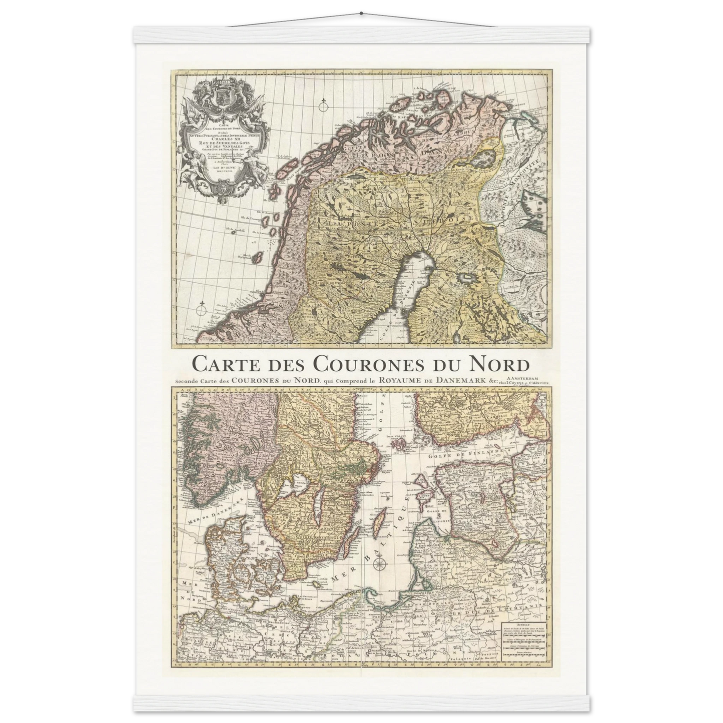
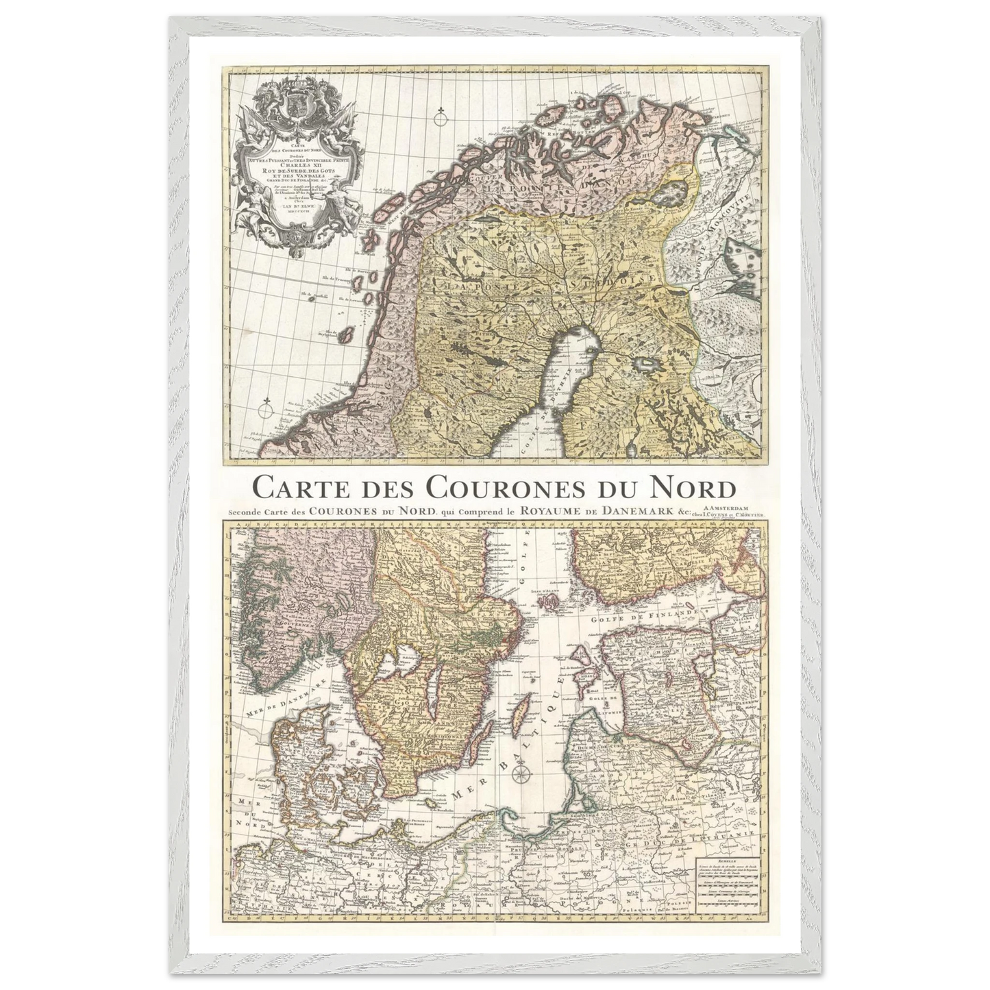
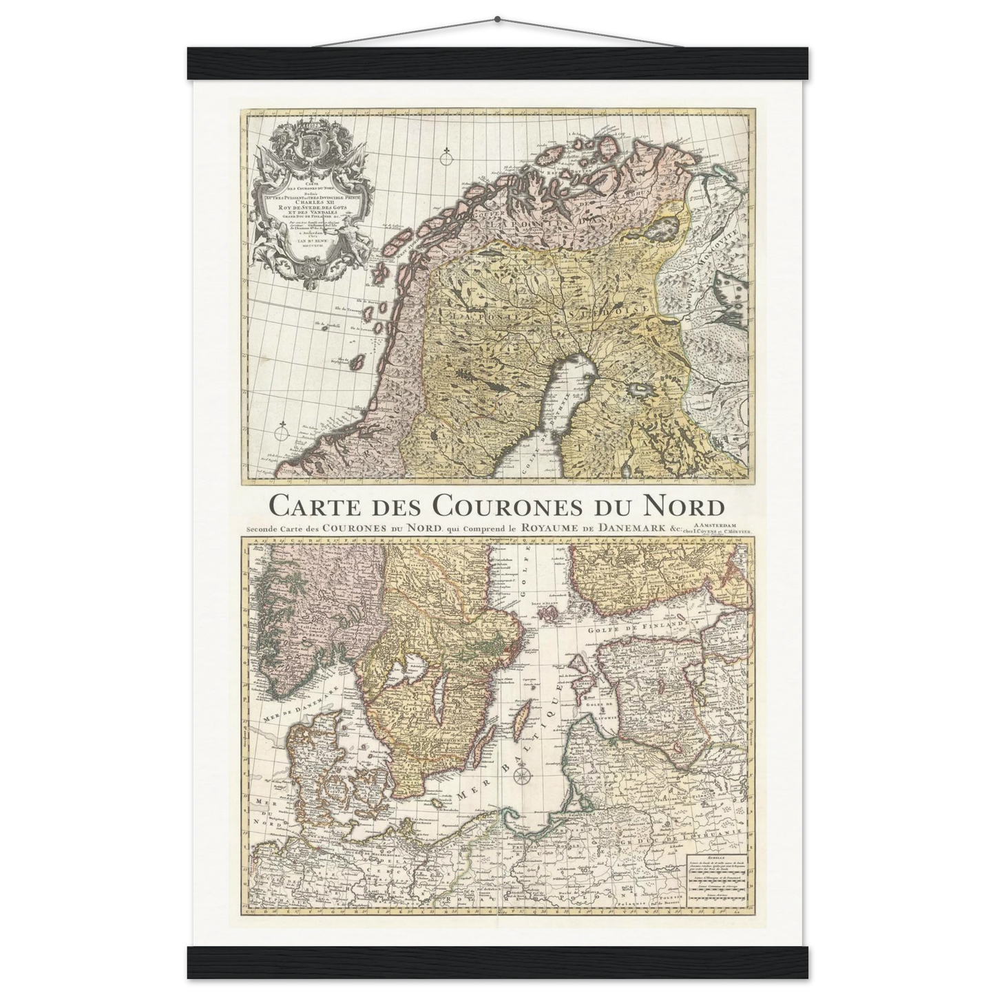
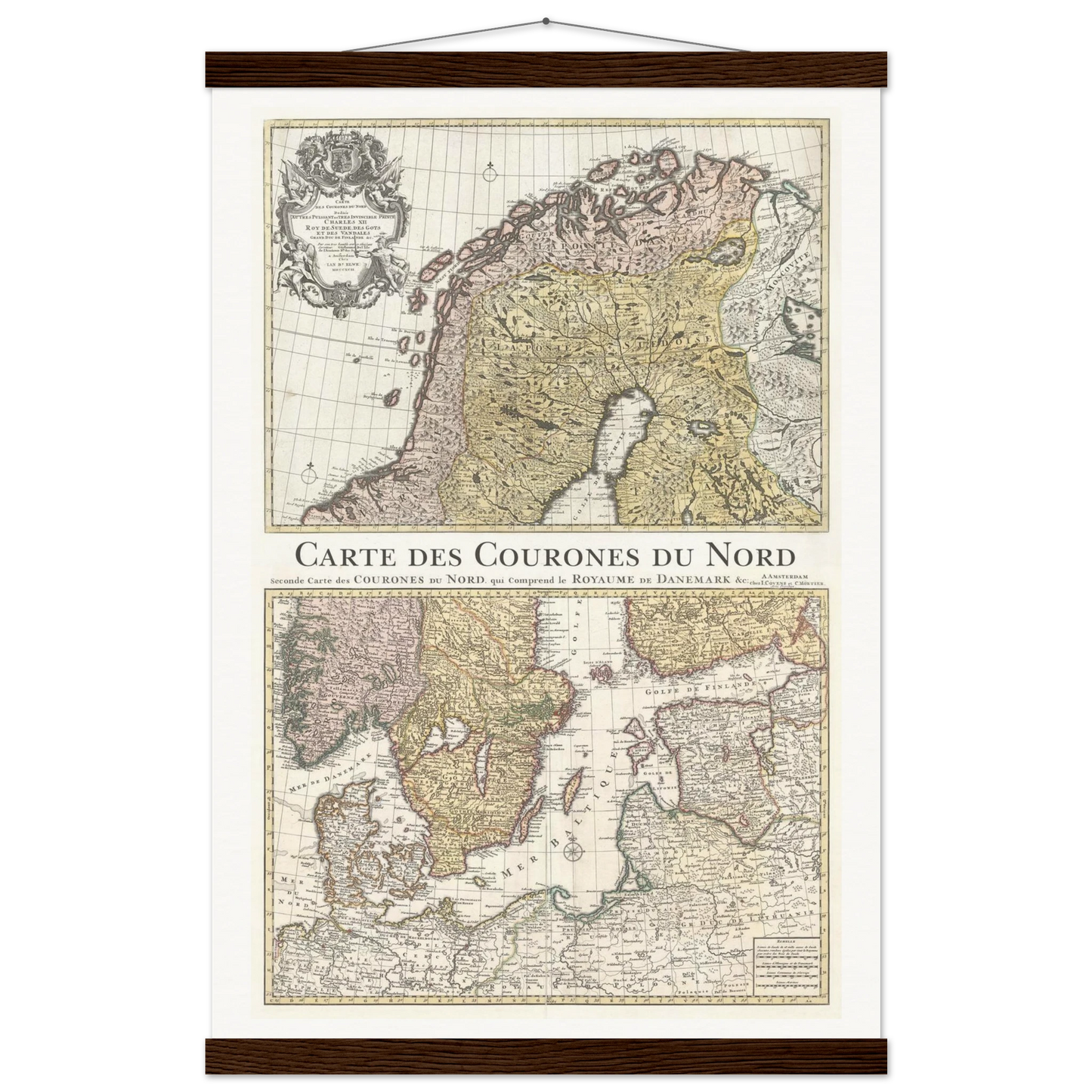
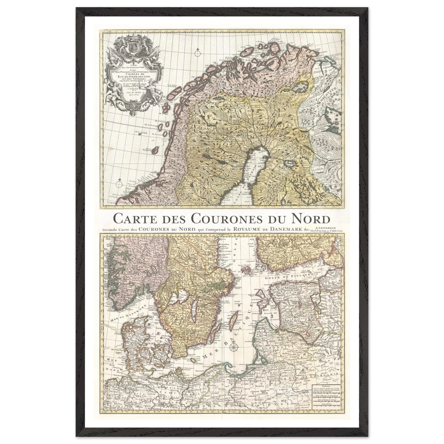
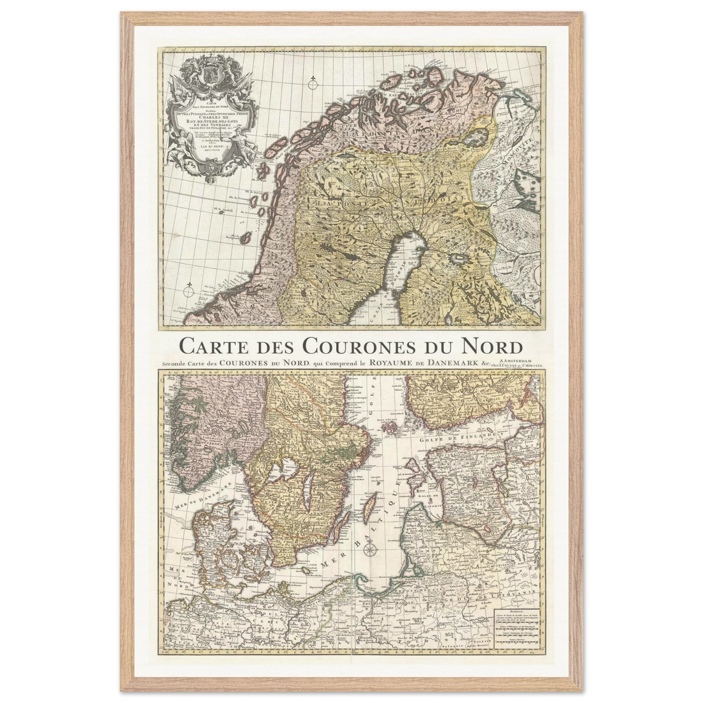
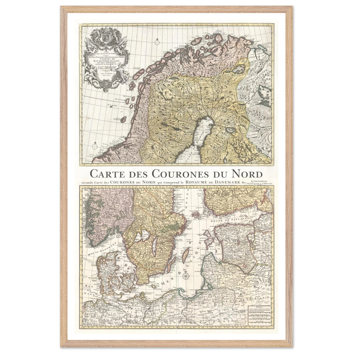
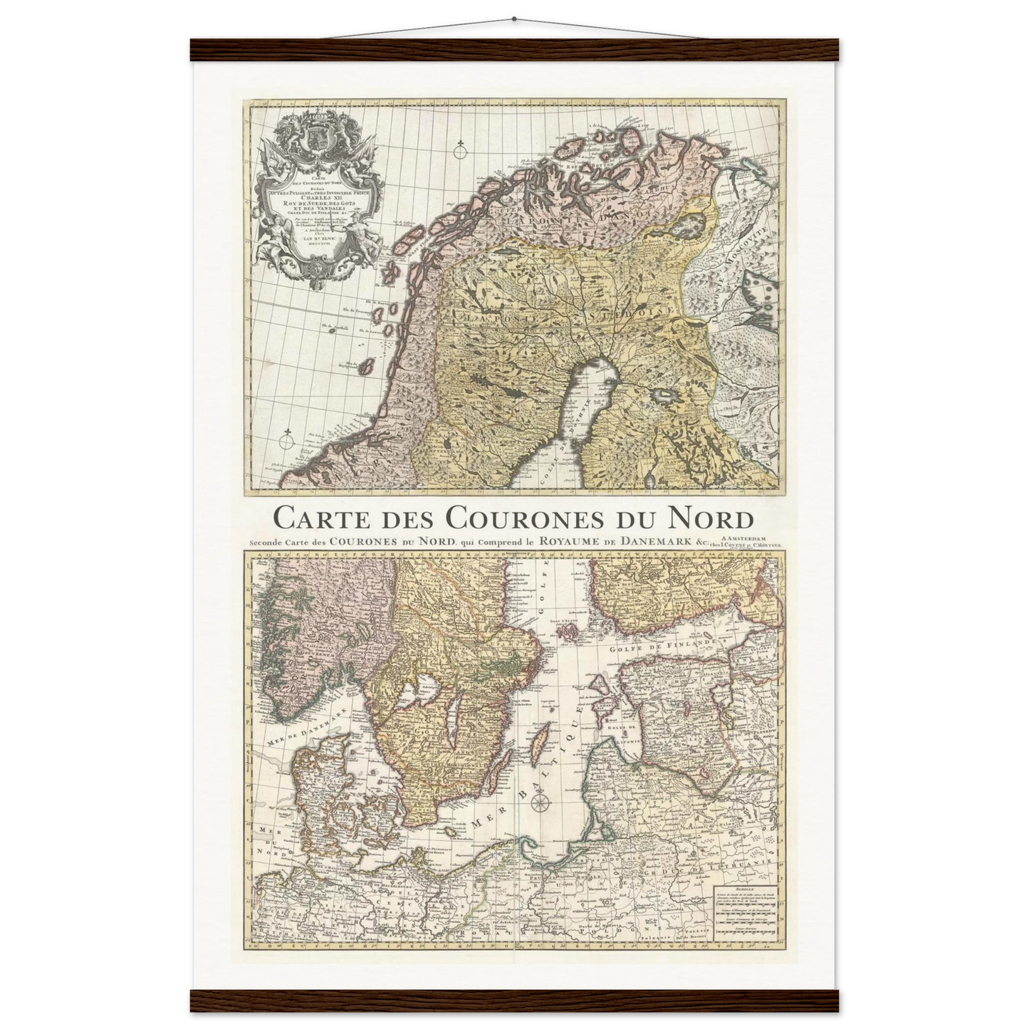
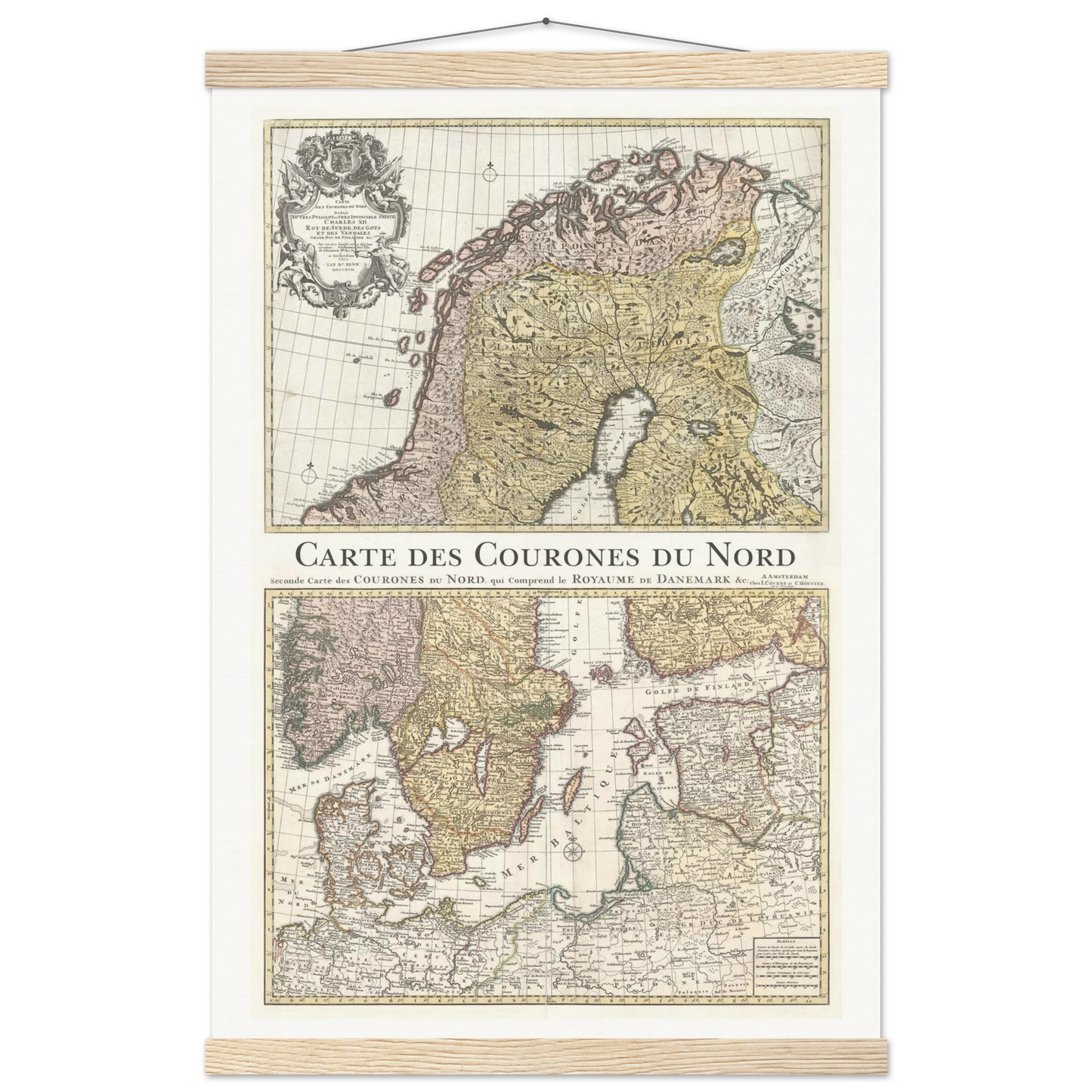
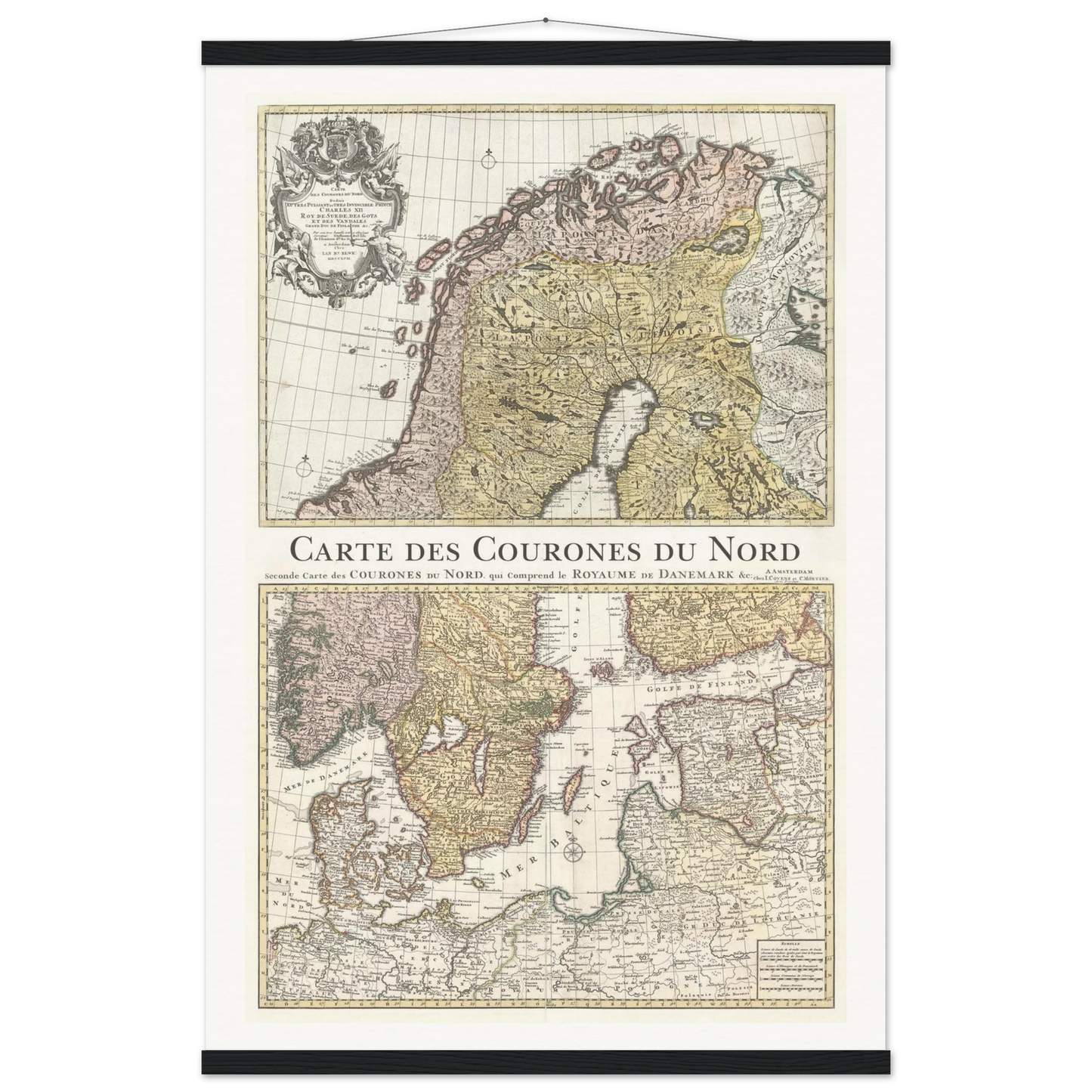
This map, titled "Cartes des Couronnes du Nord," is a detailed representation of the Nordic countries, originally created by Guillaume Delisle, one of the most esteemed cartographers of the early 18th century. Although this particular edition dates from 1792, it is based on Delisle’s earlier work, which set new standards for accuracy in European cartography.
The map depicts the kingdoms of the North—primarily Denmark, Norway, Sweden, and Finland—as well as parts of the North Atlantic and surrounding regions. It combines scientific precision with artistic elements typical of the period, featuring finely engraved geographical details and often an ornate title cartouche.
About the Cartographer: Guillaume Delisle (1675–1726) was a prominent French cartographer renowned for his dedication to accuracy. A member of the French Académie Royale des Sciences, Delisle was among the first to use astronomical observations to establish precise longitude and latitude, which greatly improved the reliability of maps during his era. His works were widely respected and frequently reprinted well into the late 18th century, as is the case with this 1792 edition. Delisle’s legacy helped shift European cartography toward a more scientific approach, influencing mapmaking for generations.
This is a special version. We have put together two maps into one with the name in the middle.